Trade Shows
Featured Article: “The Chain That Counts” from xyHt
Producing survey-grade drone data requires more than advanced sensors; it depends on an integrated workflow that ensures accuracy from collection through final deliverables.
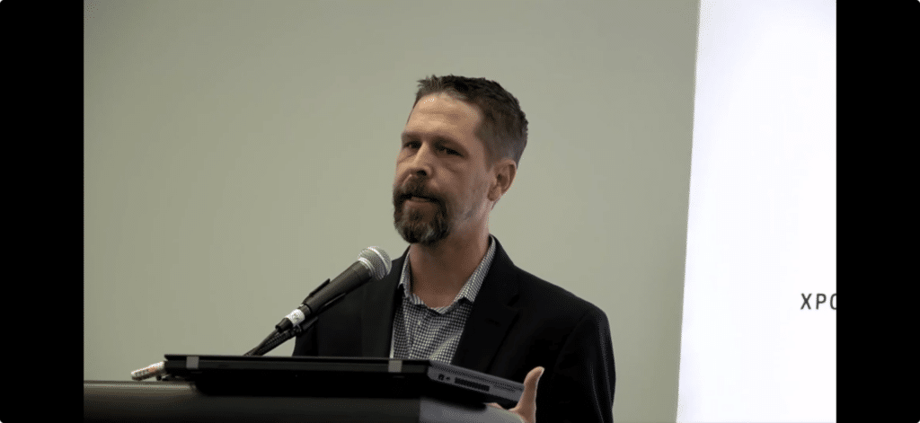
At XPONENTIAL 2026 in Detroit, industry leaders from across the geospatial ecosystem gathered to discuss one of the biggest challenges facing drone mapping today: transforming raw sensor data into survey-grade deliverables that professionals can trust. The panel explored every stage of the workflow from positioning and sensor fusion to quality assurance, GIS integration, and final project delivery.
Phoenix LiDAR President Rob Dannenberg joined representatives from Trimble Applanix, GEODNET, and Esri to share practical insights into the technologies, processes, and industry standards that help ensure reliable mapping results. The discussion also addressed evolving topics including GNSS corrections, SLAM, ground control, quality control, workforce development, and what “survey grade data” really means in today’s geospatial industry.
This article, published by xyHt, provides an excellent overview of the complete drone mapping workflow and the considerations that separate successful data collection from dependable project deliverables.
Read the full article “The Chain That Counts” on the xyHt website.
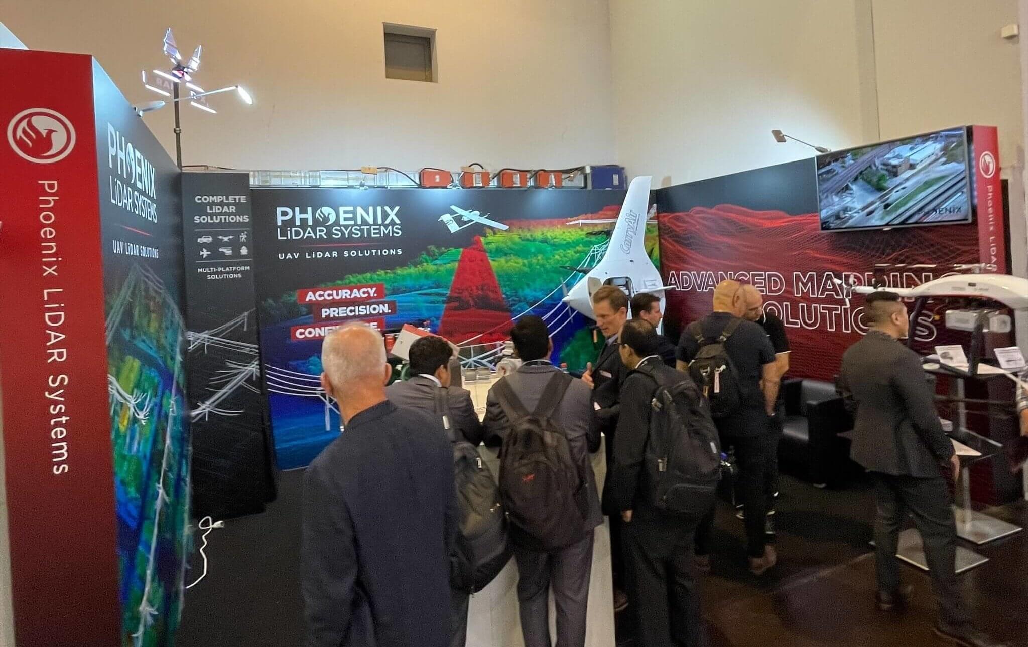
INTERGEO Oct. 18-20, 2022︱Essen, Germany
INTERGEO is the world’s leading conference trade fair for geodesy, geoinformation and land management. The largest and arguably the most impactful show for those in the Aerial LiDAR mapping space.
Phoenix LiDAR System’s surely left its mark on this year’s exhibition. We introduced a record amount of never-before-seen LiDAR innovations that rocked the industry. NEW payloads, NEW aircraft, and NEW partnerships!
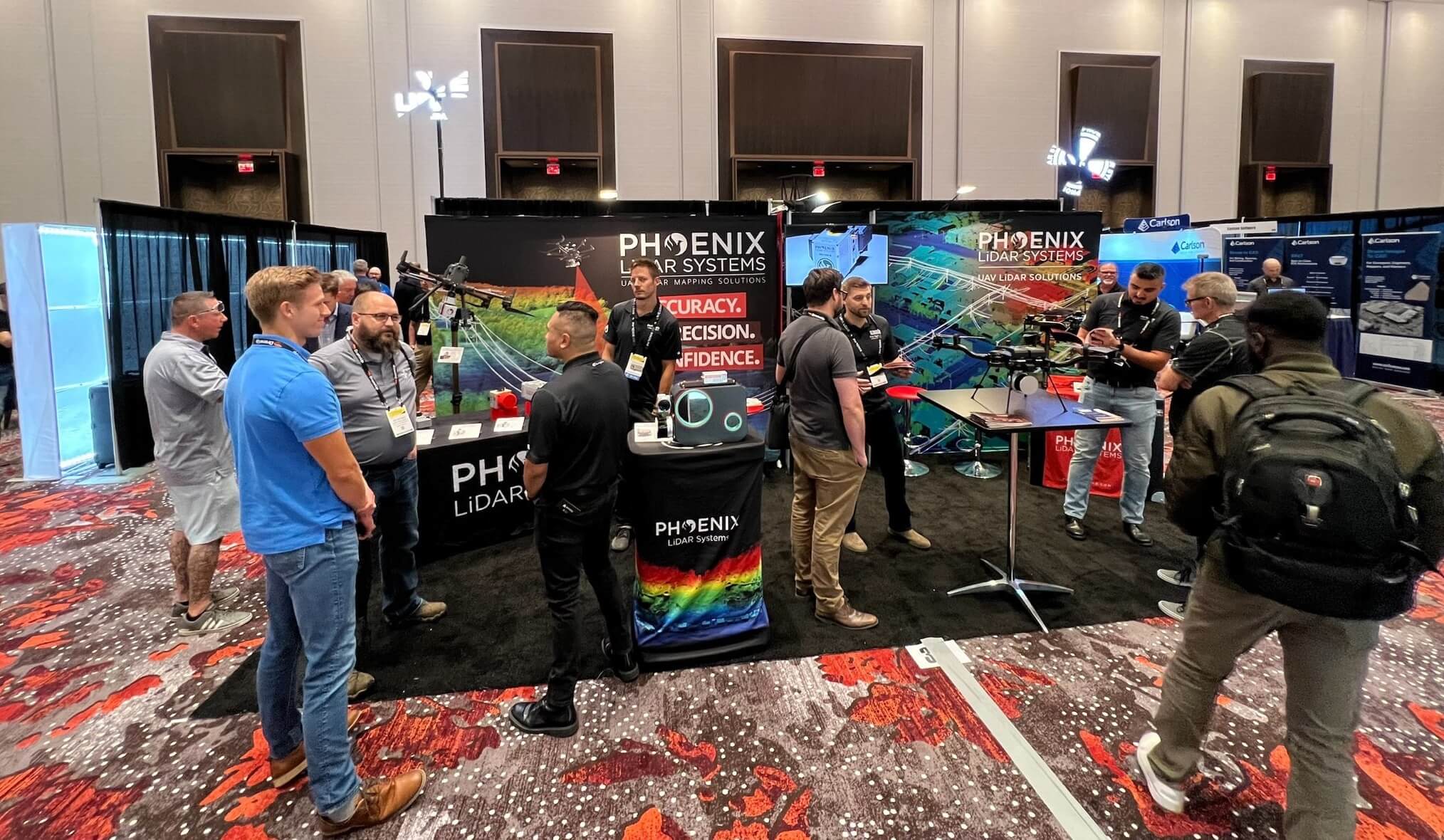
CUAV Sep. 6-8, 2022︱Las Vegas
Phoenix LiDAR Systems came into Commercial UAV Expo 2022 in full force, bringing new innovations and product features that stirred up massive excitement amongst industry professionals.
CUAV Expo is the definitive event for professionals integrating or operating commercial UAS. With top-notch education, thousands of attendees, and more exhibitors than any other commercial drone event, it’s the best opportunity of the year for anyone who needs to keep up with commercial UAS technology, trends, and developments.
We announced our new and improved PIONEER-360 payload that boasted higher precision and accuracy than ever before. Our first bathymetric LiDAR system, the HydroRANGER was exhibited for the first time since its announcement back in June.
Phoenix LiDAR was selected to present the HydroRANGER in an exclusive annual event called “Pitch the Press.” A group of industry press representatives selected only 15 exhibitors to present a new cutting edge UAV solution in the exhibit hall. Selected exhibitors were given two minutes to present their new solution, followed by a one minute Q&A. The solutions chosen represented the groundbreaking solutions in reality capture, collaborative work and visualization tools.
An amazing event overall, with many wonderful new connections forged.
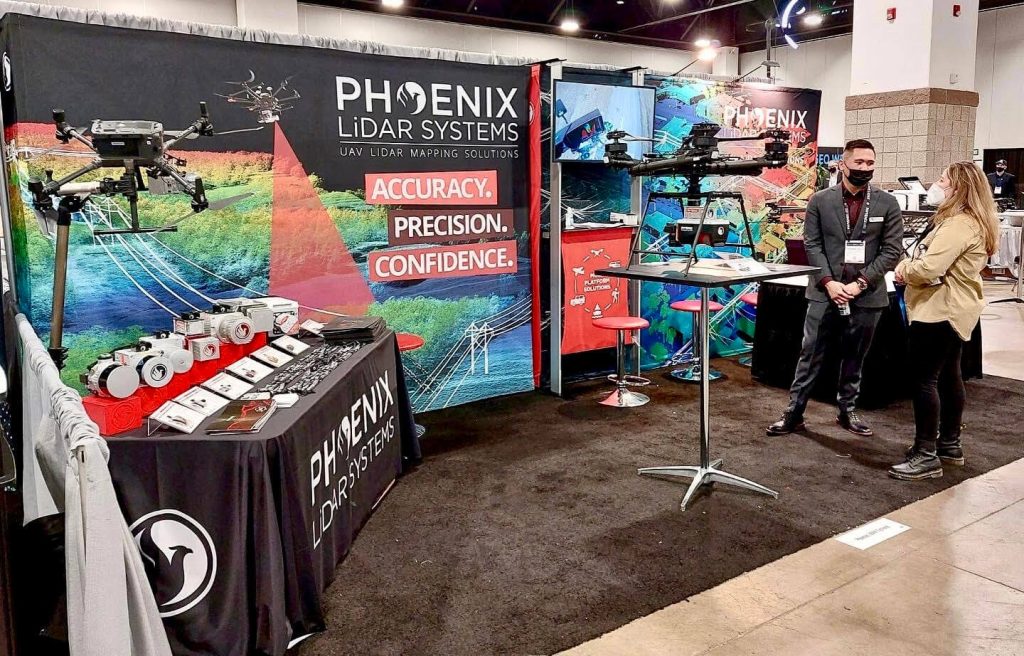
XPONENTIAL Apr. 24-28, 2022︱Orlando, FL
Our team could not have been more excited to make the return to AUVSI XPONENTIAL this year! We showcased our new integration kits, which included the DJI M600 Pro for the RECON Series as well as the DJI M300 Airframe paired with the MiniRANGER-3 Lite.
The new M300 Pro + RECON integration kit combines the power of the skyport adapter with custom vibration isolation allowing the RECONs’ to be integrated on any standard 12mm rails. M300, M600, Harris Aerial H6, Skyfront Perimeter 8, PRISM?… no problem! A strong fit for teams on a budget – The RECON solutions are designed to grow and adapt with your business. These all-in-one payloads offer ease of use and efficient data collection all at an affordable price point.
With the MiniRANGER-3 Lite + M300 integration, we combined Riegl industry leading laser precision with the ubiquitous M300 airframe, and topped the solution off with Phoenix LiDAR Systems’ renowned real-time 3D data visualization software. This package provides the next generation of mapping professionals with a compact and cost-effective tool that leverages the highest number of target echoes per laser shot offered by any M300 payload.
We enjoyed reconnecting with our partners, colleagues customers during our Wednesday night social event at Bahama Breeze. A BIG thank you to everyone who attended! We hope you enjoyed your time networking and had a great evening.
Xponential 2022 boasted an impressive display of technological advancements of uncrewed and autonomous systems. We were thrilled to have had the opportunity to collaborate and provide leading LiDAR solutions to those within the industry.
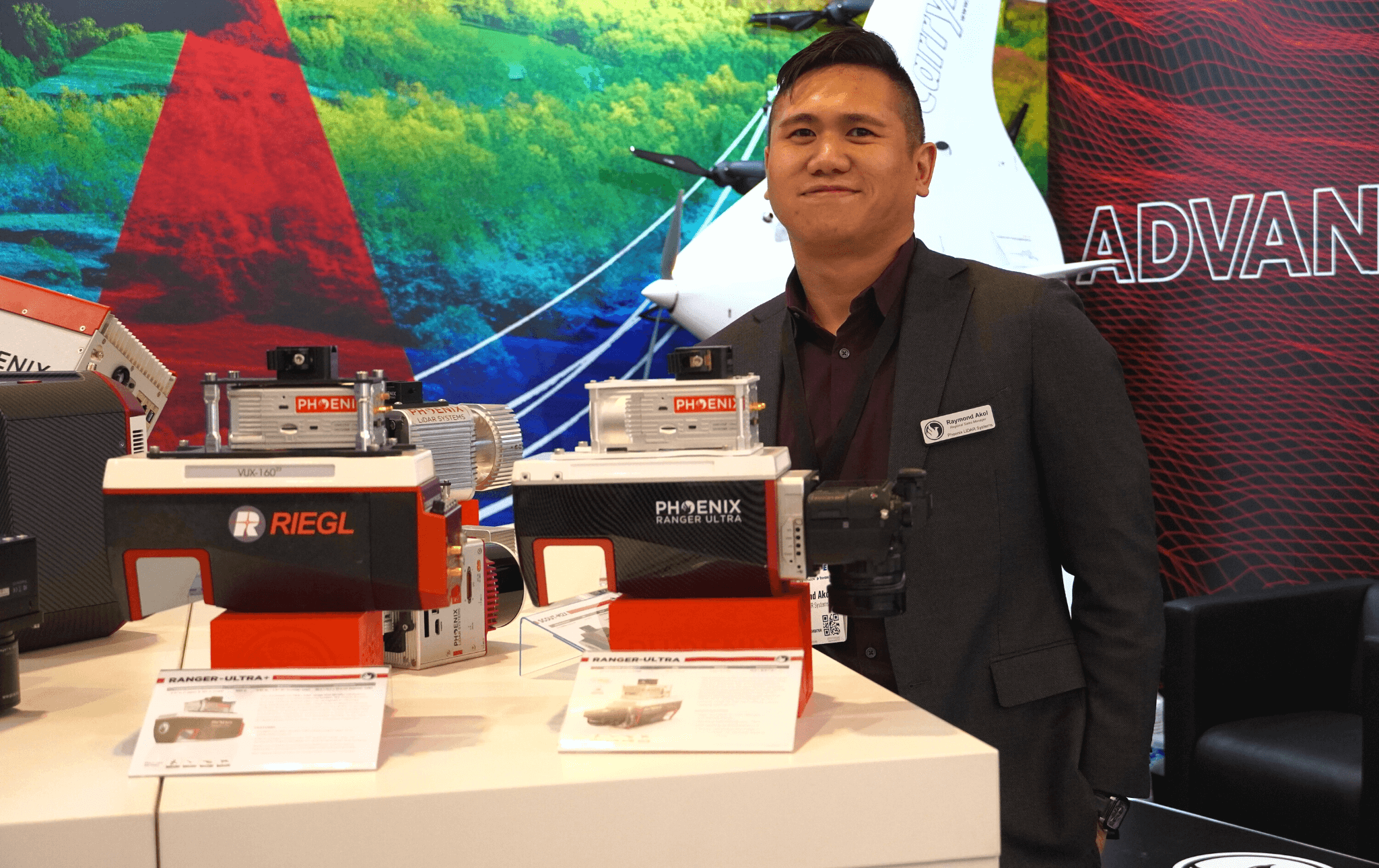
GEO Week Feb. 6-8, 2022︱Denver, CO
We had an incredible time connecting with our partners in person and sharing our full portfolio of LiDAR mapping solutions at GEO Week 2022! Our newly showcased solutions included the RECON Series, RANGER ULTRA, PIONEER P-360, and our SpatialExplorer 7 software suite.
We were especially thrilled to have had our Regional Sales Manager, Al Jarrah Habib showcase our RECON-XT in an exclusive “Pitch the Press” event. A group of industry press representatives selected only 15 exhibitors to briefly present a new solution in a one hour event. Selected exhibitors were given two minutes to present their new solution, followed by a one minute Q&A. The solutions chosen represented the cutting edge in reality capture, collaborative work and visualization tools.
Technology and its capabilities are changing constantly with new features, products, and software designed to make work safer, faster, less expensive, and better performing. Exhibiting organizations highlighted the latest technologies available during the Product Preview Presentations. Our Director of Operations, Rob Dannenberg unveiled all the new features and capabilities of Phoenix LiDAR’s SpatialExplorer 7 software suite.
In a special collaboration, our partners at SkyFront showcased our RANGER-XL at their booth and we shared their Perimeter 8 at our booth. Displayed on the Perimeter 8 during GeoWeek 2022, the Ranger ULTRA and Ranger XL are considered the leading edge of technology for survey-grade LiDAR systems in the industry and an invaluable asset for linear infrastructure and wide-area mapping Lidar data collections.
GEO Week 2022 yielded an impressive display of the latest lidar and geospatial technologies and innovative BIM use cases. Phoenix is pleased to have played a part in this year’s exhibition!

As most of you are undoubtedly aware, COVID-19 pandemic concerns have forced many businesses including all casinos along the Las Vegas strip to temporarily shut their doors. Since everyone is now advised to stay away from this area, the Phoenix LiDAR team would like to give you the next best thing – a virtual tour! Check out a beautifully colorized LiDAR scan of the Las Vegas strip collected with our Phoenix Ranger LR solution and multi-camera array by manned helicopter.
We have also included another data set to share what is possible when you utilize LiDAR data as a baseline for ground and flat surfaces, to enhance dense image matching within a third party product like Context Capture to create a robust mesh model.
There were no interiors scanned this time around. So, sadly there will be no table games or showgirls on this particular tour. However, please enjoy this impressive data set, and experience the majesty of the Vegas strip safely from your home! Happy touring and stay safe out there!