Recon
Speed: 8 m/s
Point density: ~250 points/m² per line
AGL: 120 m
No Camera Data Full FOV utilized
Speed: Walking pace for SLAM. 6 m/s UAV flight
Point density: thousands of points/m²
AGL: 80 during UAV flight
Acquisition time: ~2 hours

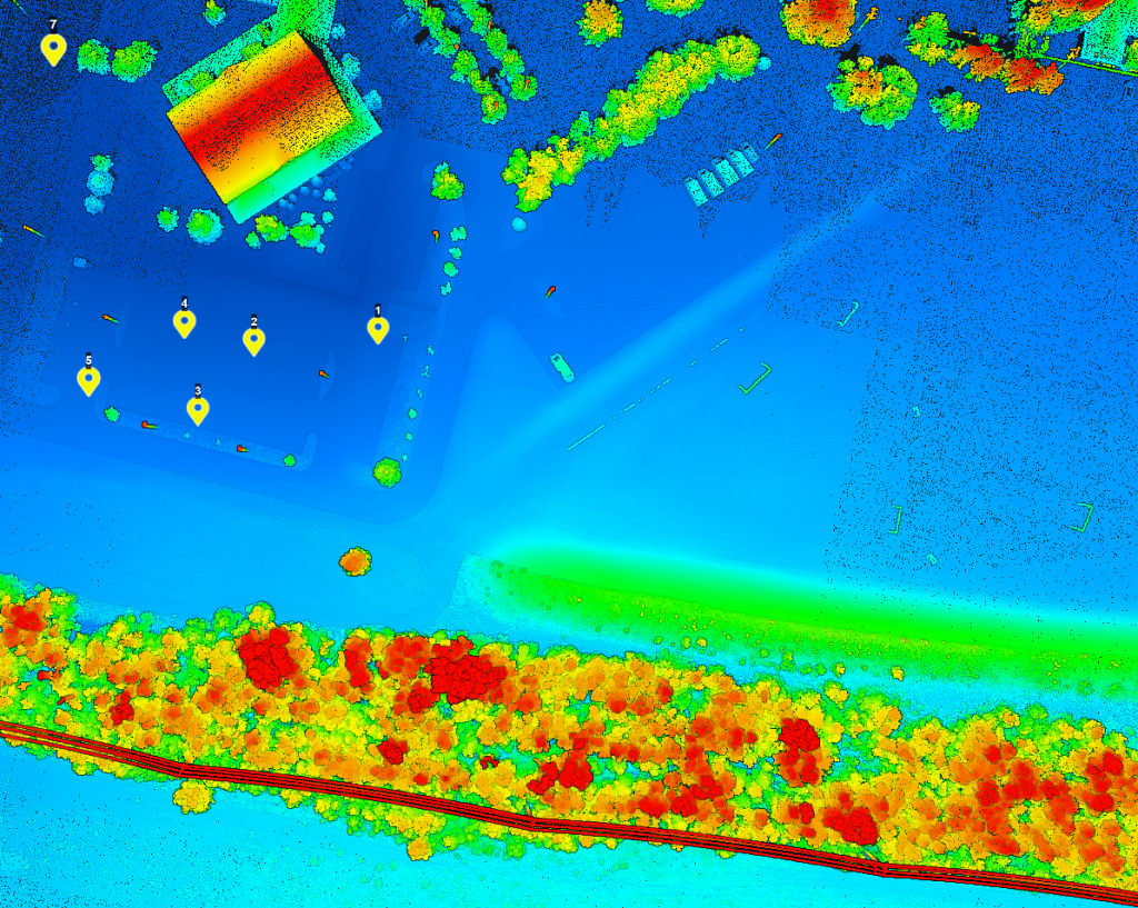
The Centralia Coal Mine in Centralia, WA, ceased operations in 2006 and is now undergoing an extensive reclamation process. A portion of the 9,800-acre site has been repurposed by Seattle’s First Mode as a proving ground for the world’s largest hydrogen-powered mine haul truck. Utilizing the Phoenix LiDAR RECON-XT, First Mode is conducting detailed 3D surveys to build and test a 10% grade haul road, essential for the truck’s performance. This innovative use of reclaimed land exemplifies how former industrial sites can be transformed into high-tech testing grounds, highlighting the synergy between environmental restoration and cutting-edge technology.
Discover the comprehensive guide to selecting the right LiDAR system with our detailed LiDAR Selection Guide. This article covers everything from the basics of LiDAR technology to in-depth comparisons of current scanners. Learn about the technical specifications, platform configurations, and software considerations essential for optimizing your LiDAR mapping projects.
Whether you are in forestry, construction, or surveying, our guide provides the insights needed to choose the best LiDAR solution for your needs. Read on to understand the advantages of UAV LiDAR, the components that make up a LiDAR system, and how to achieve high precision and accuracy in your mapping endeavors.
Phoenix LiDAR System offers survey-grade LiDAR systems for a variety of industries and applications.
Join Kory Kellum, Senior Software Engineer at Phoenix LiDAR Systems, as he explores the advanced capabilities of Phoenix LiDAR’s mapping technology in their May 2022 webinar. Phoenix LiDAR specializes in compact, adaptable, survey-grade systems for various platforms like UAVs, cars, and backpacks, and offers robust post-processing software, including LiDARMill and SpatialExplorer Pro.
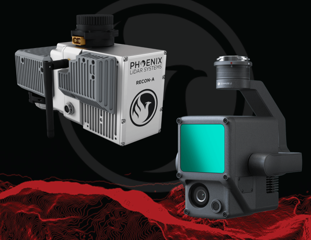
Phoenix LiDAR, based in Austin, Texas, contrasts with DJI’s recent entry into the LiDAR market. Phoenix offers comprehensive solutions, ensuring high-quality data acquisition and processing, supported by robust customer service. The Recon A system, with its superior APS-C camera sensor and vibration dampening kit, is compared to DJI’s Zenmuse L1, which is limited to the Matrice 300. The Recon A’s IMU is notably more accurate, reducing drift and improving data reliability.
Phoenix LiDAR’s LiDARMill offers advanced features like flight line splitting, ground control adjustments, AI classification, and detailed QC reports, which are not available in DJI’s Terra Pro. This comprehensive processing capability ensures high accuracy and quality in deliverable data products. A comparative analysis of data from DJI’s L1 and Phoenix LiDAR’s Recon A showcases significant differences in accuracy and precision. The Recon A system demonstrated superior performance, particularly in terms of reducing warping and improving overall data quality.
For those seeking accurate, high-quality LiDAR solutions, Phoenix LiDAR Systems provides a superior alternative with extensive support and advanced features.
Evolving the Capabilities of LiDAR
With the introduction of the RECON series, Phoenix LiDAR Systems is removing barriers to widespread LiDAR remote sensing adoption. The RECON series combines low-cost hardware with Phoenix LiDAR Systems industry leading software, LiDARMill, and is empowering a new generation of professionals like never before.
The RECON series features higher accuracies than competing products (that are based on Applanix or DJI navigation systems), while offering extremely simple, automated post-processing solutions to extract maximum value from each dataset.
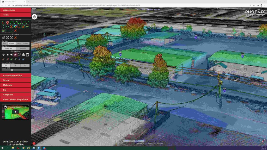
Utilizing the LiDARMill online, automated processing platform, raw datasets can be imported straight from a USB drive, with reference and optional ground control data seamlessly integrated. Simple wizards enable advanced processing options like trajectory optimization, LiDAR and camera calibration, AI classification, smart decimation and the creation of high-quality deliverables (contours, DTM/DSM/CHM, pointcloud tiling etc.). A fully registered, colorized pointcloud is produced that is accurate in both relative and absolute terms. Project reports then summarize project performance and verify system accuracy.
Phoenix Lidar Systems is committed to designing the world’s most advanced, complete LiDAR solutions. With the RECON + LiDARMill combination, users can deploy a simple toolkit that is able to derive accurate and reliable datasets in a matter of hours. Powerful, affordable, and comprehensive…the RECON series by Phoenix Lidar Systems is now available, and sure to disrupt the remote sensing industry.