Utility – Power
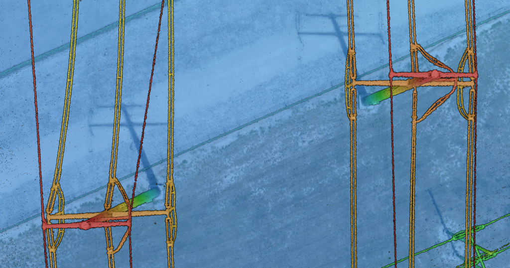
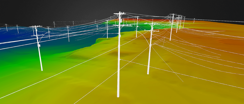
Utility companies managing power transmission networks face complex challenges in monitoring and maintaining infrastructure. The vast expanse of linear corridors and difficult terrain often render traditional survey methods impractical. Aerial LiDAR offers an efficient, innovative solution by capturing detailed tower and conductor geometries, detecting vegetation encroachment and hazards, and generating survey-grade terrain models—all with unmatched speed and accuracy.
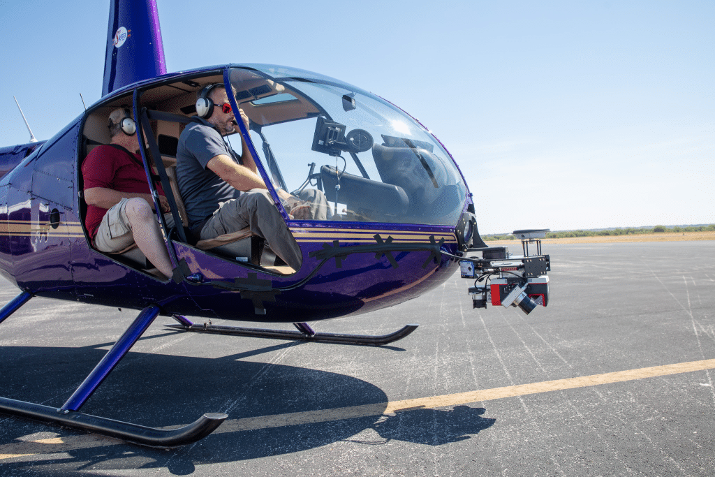
Phoenix LiDAR Systems provides flexible hardware options for every inspection task, including vehicle-mounted, UAV, and helicopter-based LiDAR systems. This adaptability ensures the right tool for any job, whether mapping narrow corridors or covering large areas.

Comprehensive Right-of-Way Mapping
Aerial LiDAR enables utility providers to efficiently collect high-density 3D data along power line corridors. With this technology, utilities can:
- Capture detailed tower structures and conductor geometries
- Detect vegetation encroachment and potential hazards
- Generate survey-grade terrain models for better clearance planning
Adaptable Hardware for Diverse Needs
Phoenix LiDAR’s vehicle-mounted, UAV, and helicopter-based systems ensure the right tool for any utility inspection task. The RANGER-U240 covers wide areas from high altitudes, the RANGER-U120 and RANGER-U160 series with their NFB VFOV allow for single pass scanning of vertical structures, while the SCOUT M2X series excels at narrow corridor mapping.
Powerful Data Processing and Insights
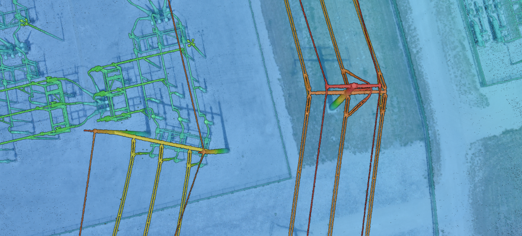
Point cloud classification and vectorization transform raw LiDAR into actionable insights, including:
- Conductor sag analysis for wire loading assessments
- Vegetation encroachment detection for maintenance planning
- Survey-grade digital elevation models for clearance planning
Key Benefits for Utility Providers
Aerial LiDAR empowers utilities to streamline critical inspection workflows, with benefits like:
- Identifying clearance issues and mitigating risks
- Improving compliance reporting and asset management
- Making data-driven decisions with survey-grade accuracy
Competitor insights reinforce the advantages of LiDAR’s accuracy, cost-effectiveness, flexibility, and safety compared to traditional methods. UAV-mounted LiDAR, in particular, enables frequent monitoring of fast-growing vegetation and surveying of hard-to-access areas.
Learn how LiDAR can revolutionize your utility inspection operations. Contact us to get started.
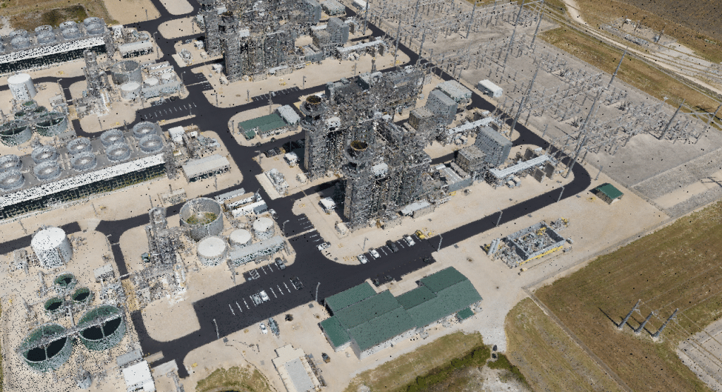
Speed: 50 kn
Point density: ~700 points/m²
AGL: 200 m
Acquisition time: 10 minutes
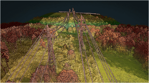
Point Density: 1050 points per m^2
Height: 120 m AGL
Speed: 10 m/s
Data Acquisition Time: 3 minutes
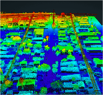
Point Density: 610 points per m^2
Height: 70 m AGL
Speed: 5 m/s
Data Acquisition Time: 26 minutes
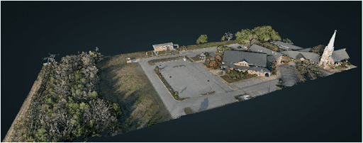
Point Density: 1050 points per m^2
Height: 120 m AGL
Speed: 10 m/s
Data Acquisition Time: 3 minutes
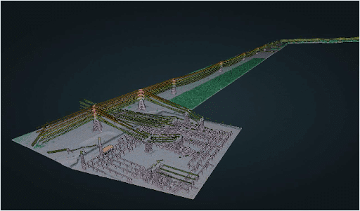
Point Density: 115 points per m^2
Height: 330 m AGL (approx.)
Speed: 50 m/s
Data Acquisition Time: 13 minutes
Join Iram Unfold from Phoenix LiDAR Systems as he delves into the transformative power of LiDAR and UAV technology for power line surveys. This comprehensive webinar covers every aspect of a survey project, from initial client interactions and RFP responses to precise data acquisition, post-processing, and final deliverables.
Discover how Phoenix LiDAR Systems’ compact, customizable LiDAR mapping systems, known for their high accuracy and 3D imaging capabilities, can revolutionize utility industry applications. Learn through a fictional case study about “Stuart’s Utility Company” and explore key considerations for sensor specifications, mission planning, and the integration of weather station data for accurate wire loading models.
Iram emphasizes the importance of accurate data acquisition, effective post-processing, and the generation of actionable insights. The session also includes a Q&A segment addressing ground control points, trajectory matching, and sensor recommendations.

Mohawk College recently partnered with the Niagara Parks Commission on a critical project, utilizing their Phoenix LiDAR Scout 32 system to achieve two key objectives. First, they generated a precision high-resolution 3D model of the historic Toronto Power Generation Station. This data is instrumental for the rehabilitation efforts to preserve this architecturally significant structure.
Second, they accurately scanned and geo-located a century-old barge that had been lodged above Niagara Falls since 1918. Dislodged by a powerful storm, the barge moved 150 meters downstream, closer to Horseshoe Falls. Niagara Parks Officials are closely monitoring its potential movement.
UAV LiDAR technology enabled the team to geo-locate the barge with centimeter-level precision and create a detailed cultural heritage preservation model of the power station. This project underscores the critical role of advanced LiDAR technology in historical preservation and environmental monitoring.
Check out their fine work and some incredible footage from the Niagara Falls project here!
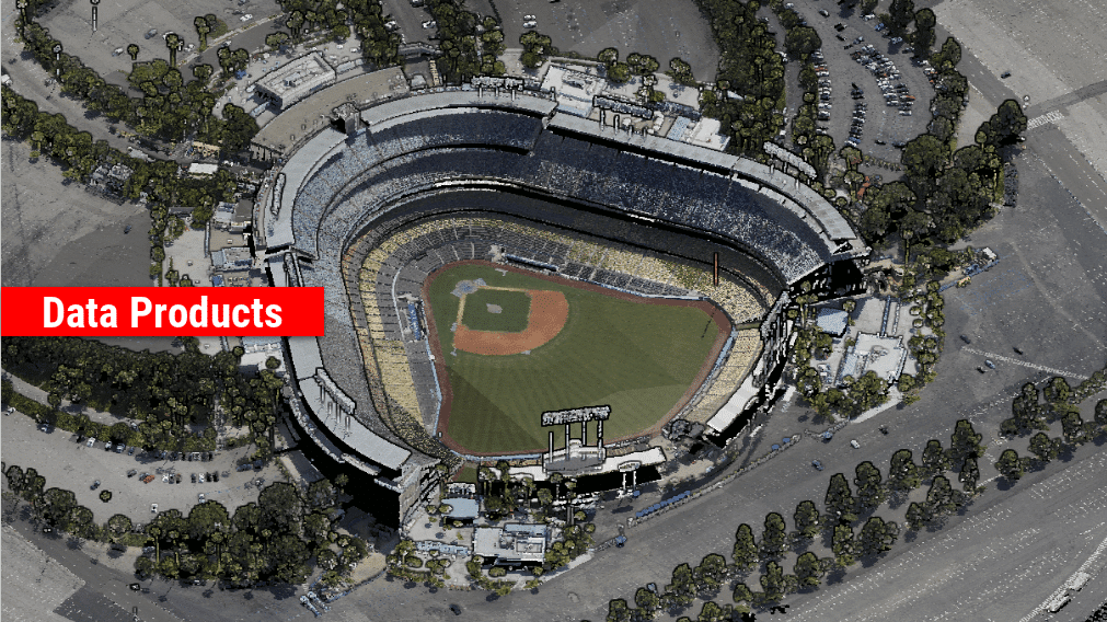
We’re excited to announce the release of LiDARMill v2! LiDARMill v2 takes automated post-processing to the next level. In our recent webinar, we covered some of the new improvements and features including:
- Imagery Processing in LiDARMill
- Ground Control Reporting and Adjustments
- Robust Coordinate System Handling
- A Workflow Overview and Demonstration
- Multi-Mission Processing Support
- Advanced Point Cloud Filtering Options
- RGB Thermal & Fusion
- Accuracy Reporting
- Automated LiDAR and Camera Calibration Options
- Near-Real Time (NRT) Reference Station Positioning for Projects Requiring Less Than 24 Hour Turn-around Time
- Trajectory Post-Processing Without Reference Stations
If you have any questions or would like to learn more about LiDARMill v2, please don’t hesitate to get in touch. We’d be happy to help!