Sample Data
Colorized RANGER-FLEX RFM2 dual head data set, utilizing the Mosaic X panoramic camera for colorization.
This RECON-F4 demo was collected during 2 flights at 80 m AGL (although this scanner is capable of producing great data even higher), 10 m/s with the RECON-F4, and processed in SpatialExplorer. Relative accuracy between flightlines came in at 0.064 US-ft, and the data hit surveyed check points at 0.07 US-ft without needing adjustment to control. The point cloud was colorized using imagery from the integrated full-frame camera.

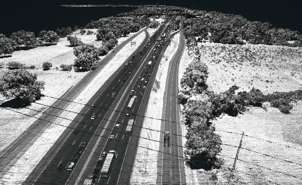
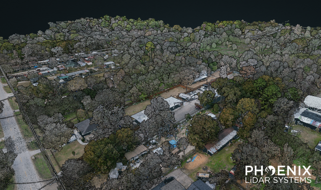
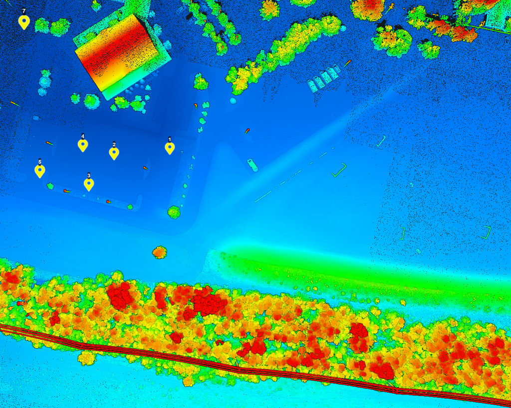
The RANGER-U240 was flown over Big Sandy Creek in Texas for post flood mapping at 250 m AGL, 65 knots. The result was 130 points/square meter, per line.
In July 2025, the Texas Hill Country experienced a devastating and deadly flooding event. As an Austin-based company, the Phoenix LiDAR team felt a strong responsibility to contribute in any way we could. First by volunteering in recovery efforts, and then by deploying our LiDAR technology to capture the effects in the aftermath.
To better understand the impact, our team conducted a manned mission with a Robinson R44 helicopter, deploying the 𝗥𝗔𝗡𝗚𝗘𝗥-𝗨𝟮𝟰𝟬 LiDAR system with a PhaseOne iXM-GS120 camera to capture high-resolution post-flood data.
Floods reshape entire communities, and understanding their impact is critical for recovery. Our team captured and processed post-flood LiDAR, creating a dataset that may be of interest to researchers, planners, and engineers working on:
- Flood modeling
- Understanding flood risks
- Infrastructure resilience
- Planning
We’re making this dataset publicly available in hopes it can support anyone who can use it for research, inform cleanup, planning, or long-term flood mitigation.
The RECON-F4 was flown at 120 m for a mapping flight at Phoenix LiDAR’s calibration site, flown at 6 m/s.
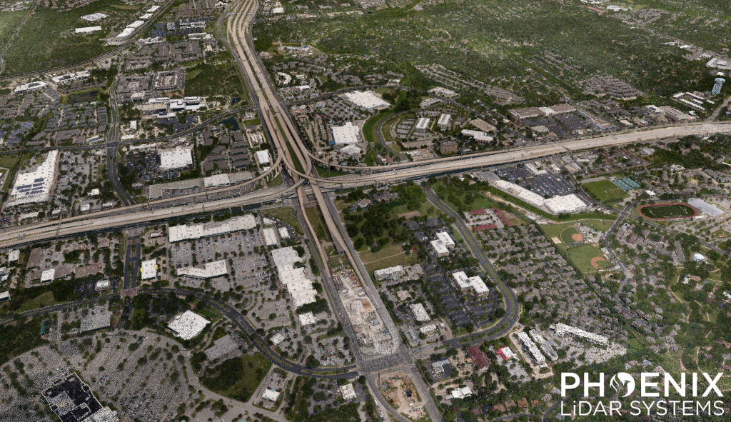
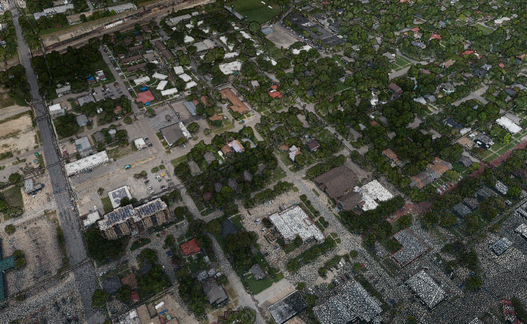
This RANGER-U580 sample dataset covers roughly 50 square miles of North Austin, Texas.
The project was flown with a Cessna 172 at 75 knots and 615 m above ground level. Data was processed in SpatialExplorer version 9.
Results:
34 points/m², per flight line
7 cm GSD
Full RANGER-U580 dataset available for download. Contact our team at sales@phoenixlidar.com for a link to download.
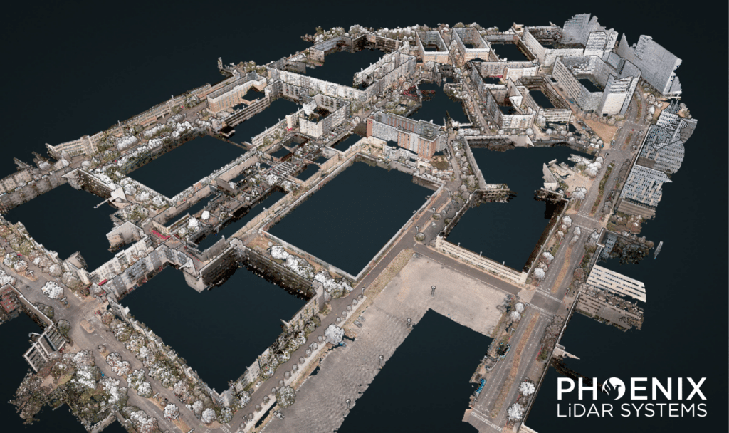
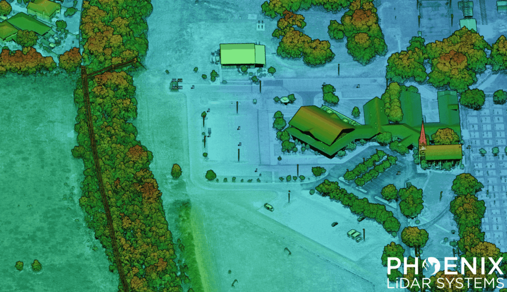
Check out our RANGER-Flex 𝗠𝗼𝗯𝗶𝗹𝗲 + 𝗔𝗲𝗿𝗶𝗮𝗹 𝗱𝗮𝘁𝗮 𝘀𝗲𝘁 of the University of Central Florida – Rosen College of Hospitality Management, recorded during the 2025 TopoDOT User Conference.
This data set features mobile and aerial scans by the RANGER-Flex, which were matched together using 𝗟𝗶𝗗𝗔𝗥𝗦𝗻𝗮𝗽. First, the site was flown using a single 𝗥𝗔𝗡𝗚𝗘𝗥-𝗙𝗹𝗲𝘅 LiDAR system mounted to a Harris Aerial 𝗛𝟲𝗘. Then, this same aerial LiDAR system was mounted inside the 𝗥𝗙𝗠𝟮 𝗺𝗼𝗯𝗶𝗹𝗲 𝘀𝘆𝘀𝘁𝗲𝗺, which enables dual-head mobile LiDAR collection.
Once the mobile data set was collected, the scans were matched together automatically using 𝗟𝗶𝗗𝗔𝗥𝗦𝗻𝗮𝗽’𝘀 𝗖𝗼𝗻𝘁𝗿𝗼𝗹 𝗖𝗹𝗼𝘂𝗱 functionality. Both scans were then colorized using the 𝟲𝟭 𝗠𝗣 𝗥𝟲 aerial camera.
Full Dataset available for download. Contact our team at sales@phoenixlidar.com for a link to download.
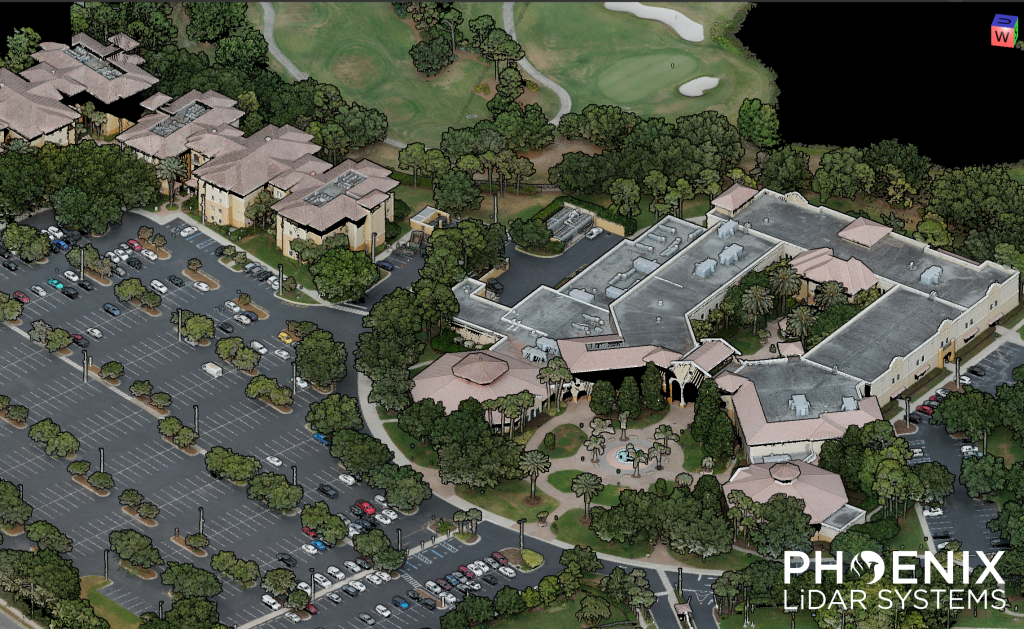
Speed: 8 m/s
Point density: ~250 points/m² per line
AGL: 120 m
No Camera Data Full FOV utilized